
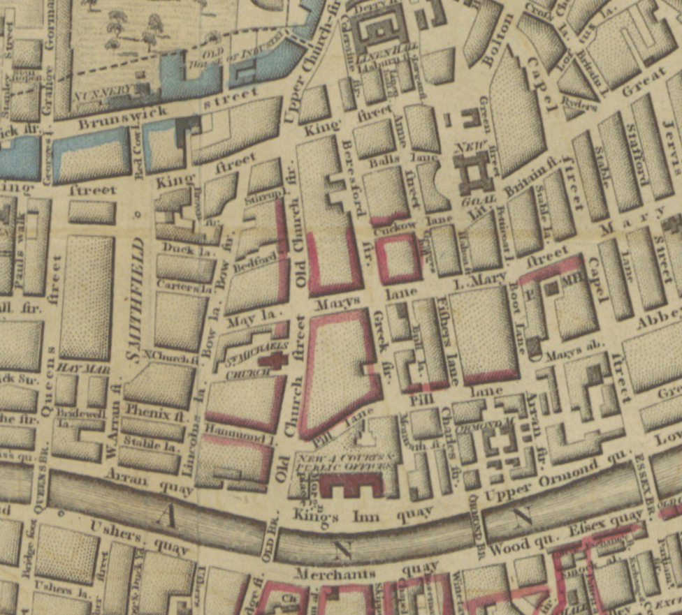
The Modern Plan of the City of Dublin (1798) may have been the first to show Ireland’s Four Courts, formally opened in 1796. It can be seen from the extract shown above that the original Four Courts building designed by James Gandon was relatively small compared to the size of the Four Courts complex today, and quite hemmed in by surrounding houses.

Since then, not only has the Four Courts site expanded to take in the southern side of that once famous shopping street, Pill Lane, but the area to the east of the Courts has been completely configured to create Chancery Street. Many of the streets shown in this area of the map have been renamed or removed entirely. Neither the Ormond Market nor the notorious Bull Lane survive today. Pill Lane is now called Chancery Street and Boot Lane Arran Street.

In 1798, each of these streets to the east of the Four Courts was uniquely distinct and different. Bull Lane was a street of brothels, unrestrained by the presence of a police station a minute or so away in Mountrath Street. Mary’s Lane, more respectable, was where you would find old clothes sellers. Fisher’s Lane, while also respectable, was filled with slaughterhouses which posed a constant public nuisance.
Zoomable version of plan here.

Leave a Reply