
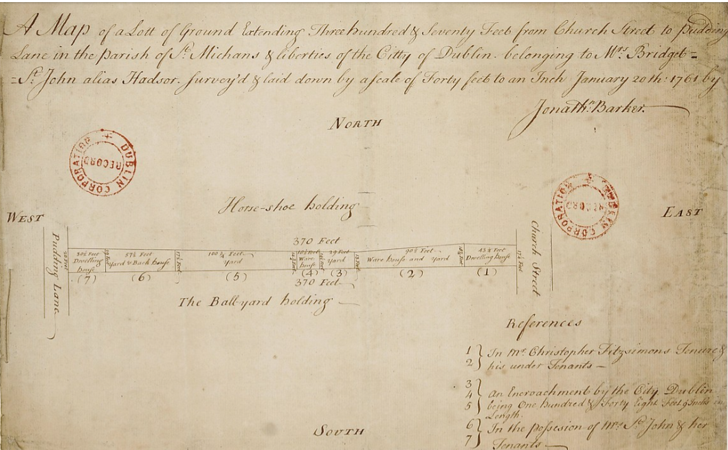
The above 18th century map from the Digital Repository of Ireland, via Europeana (zoom in here) delineates a narrow strip of land at the southern end of Church Street, Dublin, Ireland owned by Bridget St John, nee Hadsor and let by her to various tenants. The references to the adjacent ‘Ball Yard Holding’ and ‘Pudding Lane’ make it easy to pinpoint its location, since both are identified on Rocque’s map of the period (extract below)


Pudding Lane is now the street known as Lincoln Lane (image above) connecting Arran Quay and Smithfield, and Bridget’s holding and the adjacent Ball Yard site now form part of the Arran Quay development occupied by barristers’ offices (image below).

The Hadsors, an Anglo-Norman family, had a long association with both Church Street and the legal profession – Bridget, who was involved in a legal property dispute herself, would probably have approved of its current use.
The presence of the vacant Ball Yard nearby made Pudding Lane quite a dangerous place in the 18th century. Saunders’s News-Letter of 1782 reports a William Giles having been attacked there by two armed robbers, who, following his refusal of their demand for money, twice attempted to shoot him. Luckily, the gun misfired and the attackers fled after the redoubtable Mr Giles pulled out a small sword and wounded one of them in the thigh.
It was just as well that Mr Giles was able to look after himself, as there were no watchmen about, and two sedan chair carriers at a door on Arran Quay refused to help, saying it was none of their business. Some might say little has changed in those parts!

Leave a Reply